Mapping & GIS

Prairieview Geomatics is proud to offer mapping & GIS services to fit your needs.
 

At Prairieview Geomatics we use the advanced drone technology to capture high-resolution property imagery across Canada. We understand that outdated property information can create challenges, so our services are designed to give you a cost-effective way to keep your data up to date.

With our GIS & aerial mapping services we can help you monitor land use and visualize important and valuable information including topography, property boundaries, accurate volumetric information on stockpiles, and infrastructure details.

We provide interactive maps of your property through a web portal, and deliver data in a variety of industry-standard formats ensuring seamless integration into your systems.

We'd love to discuss how our services can work for you. A quick conversation can help us tailor our solutions to fit your needs perfectly. Don't hesitate to reach out whenever you're ready, and let's see what we can achieve together.


Examples of mapping & GIS services that we are able to provide:

Orthomosaic

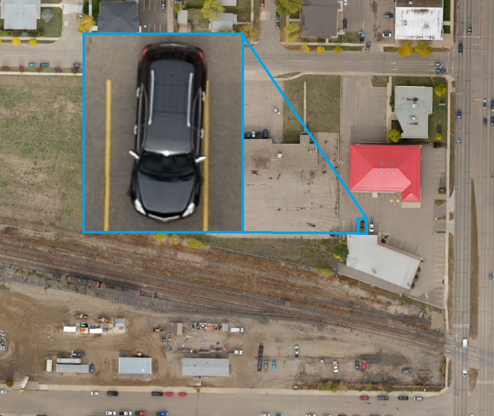
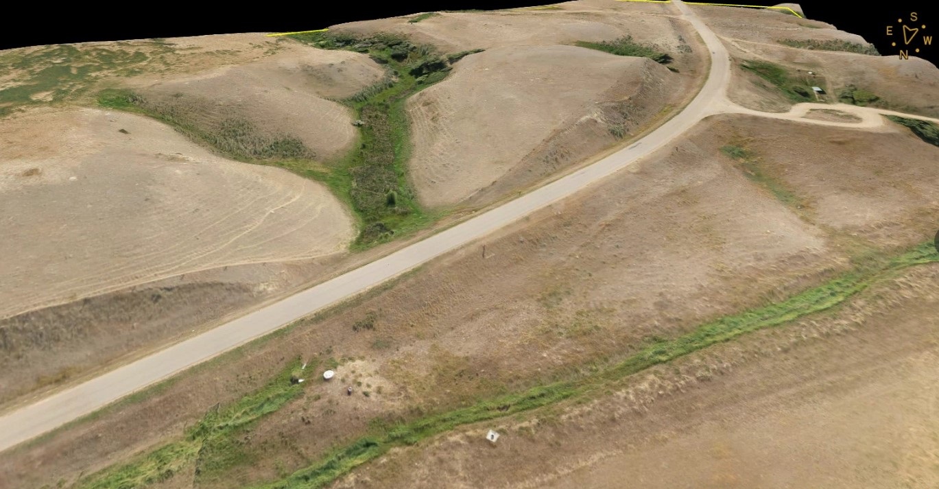
Our Orthomosaics can provide high-resolution (2.25CM per pixel) accurate and up-to-date aerial imagery.

Having a comprehensive and detailed visual representation of your property allows you to easily make precise measurements and assessments. It enhances site planning and development, which allows you to monitor changes over time. This can help improve asset management, and support accurate records.

Orthomosaics can also facilitate good communication through clear, detailed maps.

Deliverables:
  • Images (.jpg, .png, .tiff)
  • KMZ (Google Earth)
  • Custom Printable Maps

Point Cloud

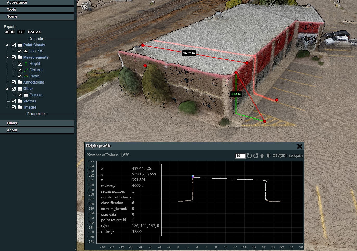
We can provide a highly detailed and accurate 3D representation of your entire property or area.

Our point clouds contain data points that provide precise locations and elevations of every feature on your property, from buildings to the smallest surface details.

This allows you to perform measurements, line extraction or the ability to generate your own meshes.

You'll be able to conduct virtual inspections, generate precise blueprints, and simulate various scenarios for better planning and development.

Deliverables:
  • Point Cloud (.las, .pts, .txt)
  • Web-viewer with point to point measurement

Topographic Surveying

We can transform your property management and analysis with tools that allow you to visualize elevation changes across your property with precision.

This is perfect for planning construction projects, designing landscapes, and assessing flood risks. Our software mapping capabilities allow for detailed 3D representations of the terrain capturing every landscape nuance.

This allows us to perform accurate topographic analysis, monitor land deformation, and optimize site layouts.

By working with us you gain the ability to conduct detailed land assessments, make smarter decisions, and streamline your project planning. This will ultimately save you time and resources.

Deliverables:
  • Surface (.tin)
  • Digital Elevation Model (.tiff, .asc)
  • Contour Lines

Stockpile Inventory


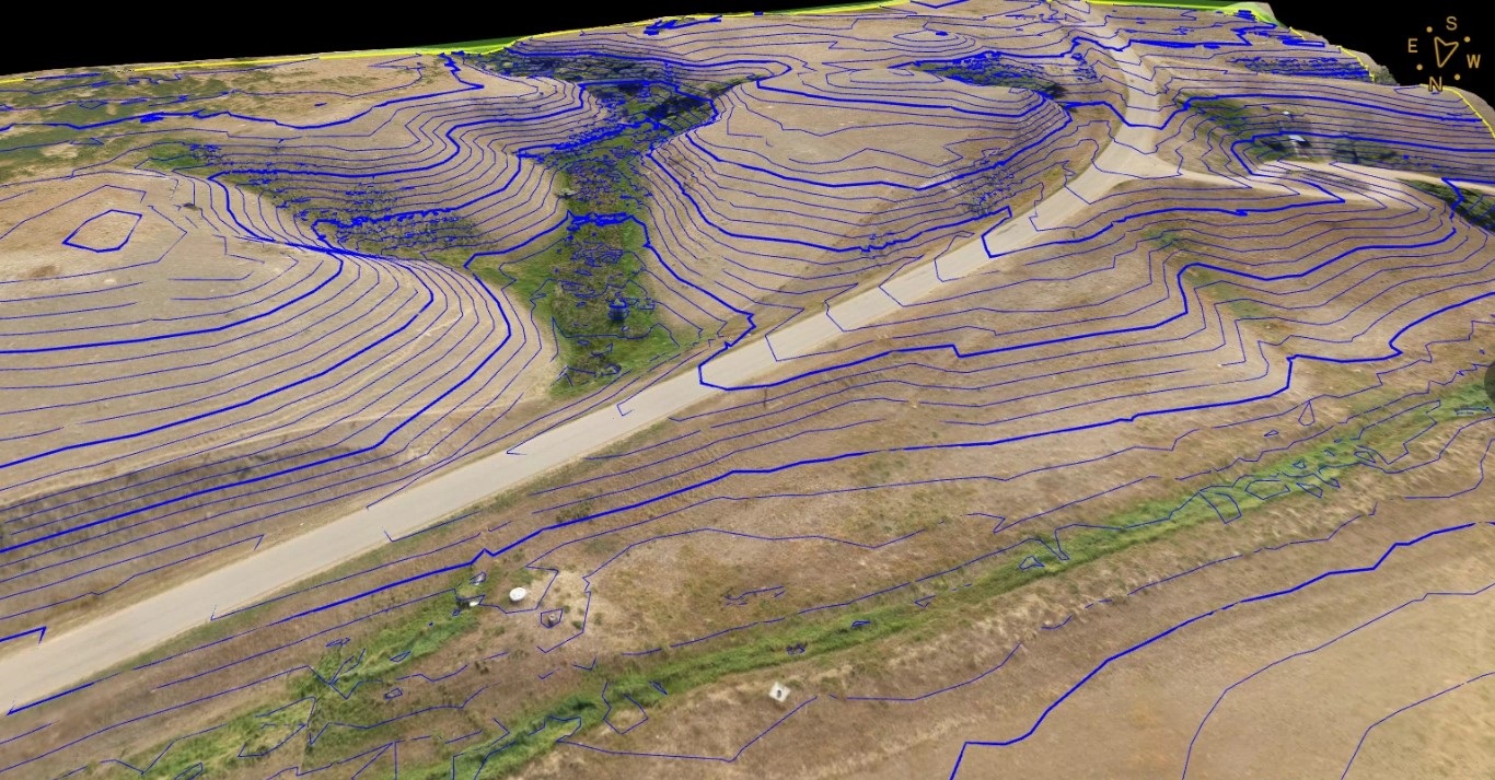
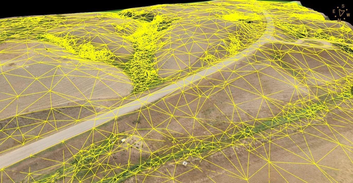
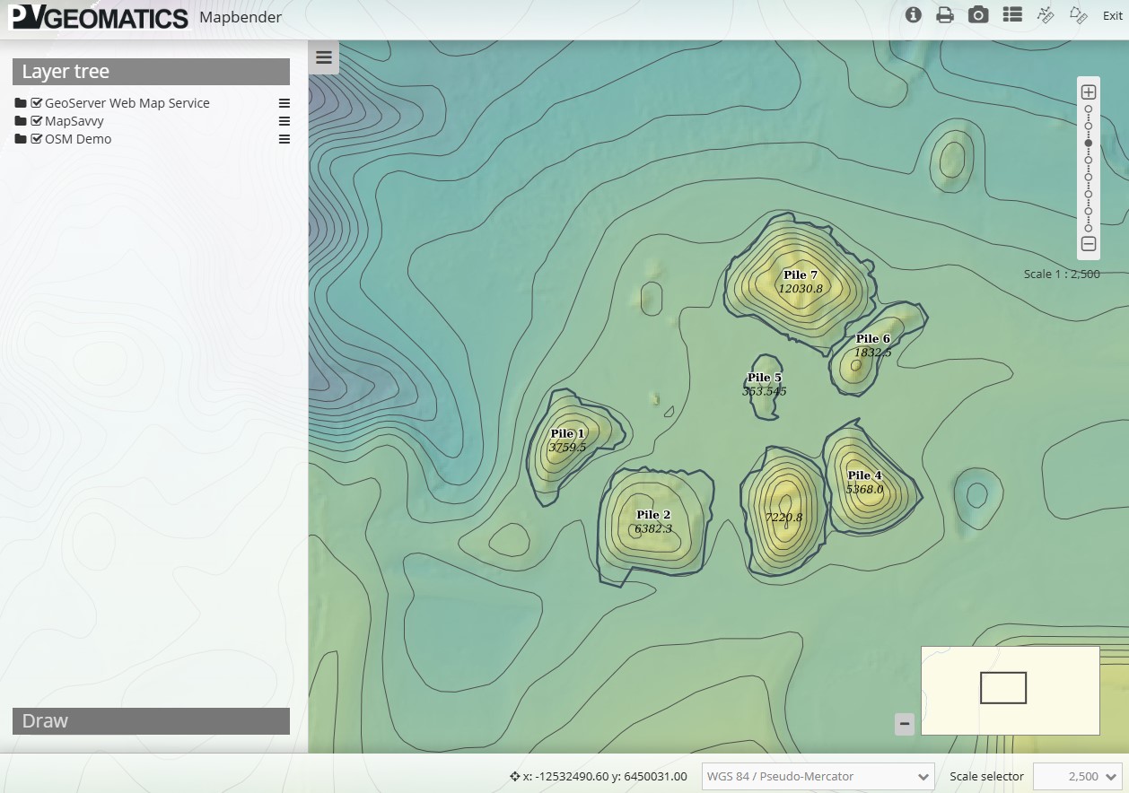
We can accurately measure the volume of materials on your site without the hassle of traditional methods.

Aerial volume sampling provides an efficient and accurate method for measuring the volume of materials or features on a site, such as stockpiles, excavation areas, and landfills.

This method of capturing and calculating volume information saves time and resources.

Knowing exact material quantities is crucial for inventory management, project planning, and cost estimation. Our solution streamlines this process. It also enhances safety by reducing the need for personnel to enter potentially dangerous areas.

We can help you make informed decisions, optimize your resources, and improve operational efficiency.

Deliverables:
  • PDF Report
  • Excel Spreadsheet
  • Cut/Fill Maps

Would you like to start a project with us?

We are certified by Transport Canada to conduct advanced operations nationwide. Feel free to get in touch by phone, email or by using our website.